


Hi Folks,
Ever wonder what would happen if we doubled the terrain mesh resolution from [ 8m or 65,536 data point per tile ] to [ 4m or 262,144 data points per tile ] in ORTS?
I have...
4m ORTS terrain created from 1m LIDAR Geodata displayed in TSRE GenX v0.12
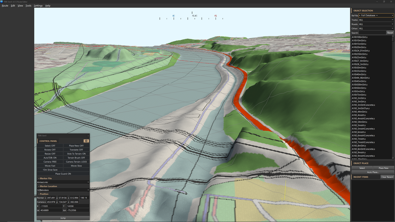
You almost don't need to manipulate terrain - just place your road and track sections down and you're done.
Just an experiment.

Regards,
Scott
PS - I think I solved the LIDEX Terrain Mesh to Map Tile coordination issue.
Ever wonder what would happen if we doubled the terrain mesh resolution from [ 8m or 65,536 data point per tile ] to [ 4m or 262,144 data points per tile ] in ORTS?
I have...
4m ORTS terrain created from 1m LIDAR Geodata displayed in TSRE GenX v0.12
You almost don't need to manipulate terrain - just place your road and track sections down and you're done.
Just an experiment.
Regards,
Scott
PS - I think I solved the LIDEX Terrain Mesh to Map Tile coordination issue.


Comment